Uncovering Hidden Reefs of Marine Park Bay, Tioman 揭秘刁曼岛海洋公园湾的隐秘海底
GUE Project Brief · 2025 GUE 项目记录 · 2025
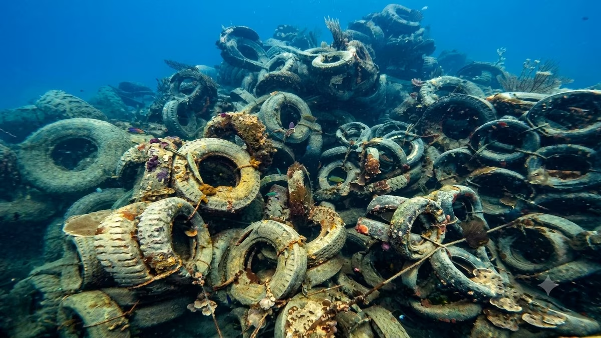
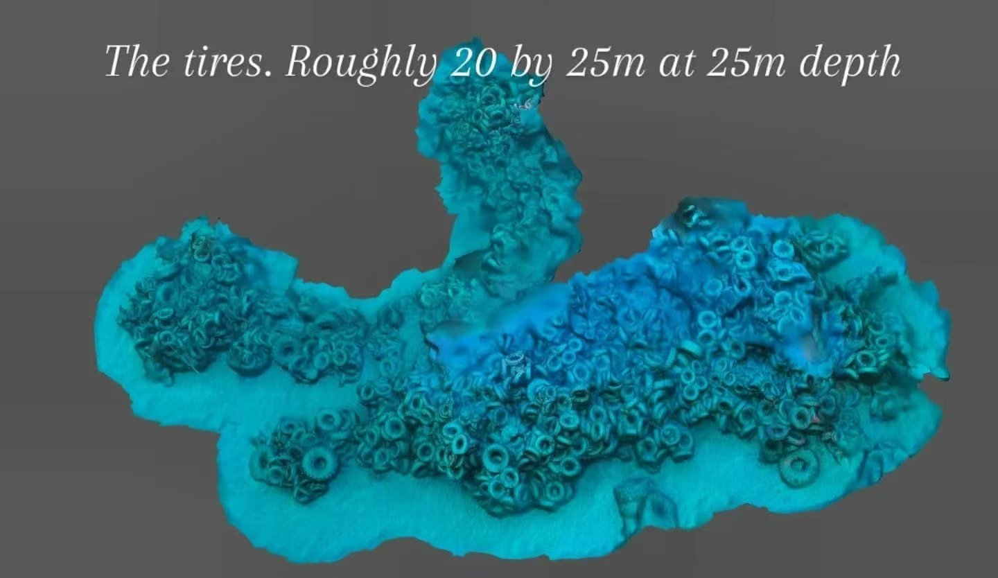
Marine Park Jetty sits between Tekek and ABC on Tioman Island. It's calm, the vis isn't great, and the bottom slopes from about 14 to 30 metres. Most divers swim past it on the way to the coral gardens further along the bay. We didn't. Underneath are sunken wrecks, concrete blocks, and something I wasn't expecting on a first visit: a field of hundreds of car tyres on the seafloor, put there on purpose, decades ago.
This GUE project is what came out of that. Find everything down there. Map it. Figure out how it got there. Tell the story.
刁曼岛 Tekek 和 ABC 码头之间,是海洋公园码头(Marine Park Jetty)。水面平静,能见度一般,水深从 14 米到 30 米。大多数潜水员路过这里,去更远处的珊瑚礁。我们没有。底下有沉船、混凝土块,还有一样我第一次看到时没想到的东西:几百个被人故意沉到海底的旧轮胎,已经在那儿几十年了。
这个 GUE 项目就是这么来的。把底下的东西全找出来。画成图。搞清楚它们怎么来的。把故事讲出来。
They aren't random dumping. They're left over from a government programme that started in Kedah in 1975 and ran through the 80s and 90s. Malaysian coastal fisheries were collapsing, so the government built artificial reefs to give fish new habitats and shield the live coral from trawlers. Used tyres were everywhere, heavy, and free; on paper it made sense. By the time the programme wound down, over a million tyres had been sunk across hundreds of sites along the Malaysian coast.
The intentions were sound. The outcomes were mixed. The tyres turned out to be lighter and less stable than planned: ropes rotted, storms moved them around, and in some places they ended up crushing the reefs they were meant to protect. Coral doesn't grip smooth rubber well either, so biodiversity stayed lower than on concrete or steel reefs. Florida's Osborne Reef (two million tyres off Fort Lauderdale) is the cautionary tale; that one took twenty years of cleanup. Malaysia eventually shifted to concrete blocks, retired ships, and engineered modules.
The Tioman tyres are what that era left behind. They've been on the seafloor for somewhere between 25 and 40 years.
A note on context: whatever their ecological score, the tyres are a habitat now. Fish shelter under them, some coral has actually taken hold, and the site has real history. We're here to document and understand, not to judge.
背景说明:不管它们的生态评价怎么样,这些轮胎现在已经是一个真实的栖息地。鱼会躲在底下,珊瑚也已经在上面长出来了,这里本身有它的历史。我们来这里是为了记录和理解,不是评判。
这片轮胎不是乱倒的,是一个政府项目留下来的。项目从 1975 年的吉打州开始,一直延续到 80、90 年代。当时马来西亚沿海渔业严重衰退,政府想用人工礁给鱼造新家,同时保护活珊瑚不被拖网破坏。旧轮胎到处都是,又重又免费,看起来很合理。项目结束时,超过一百万个轮胎被沉到了马来西亚沿海的数百个海域。
出发点是好的,结果不太理想。轮胎比预想中更轻、更不稳定:绳子烂了,风暴一来就被冲走,有的地方反而把它们要保护的珊瑚压坏了。橡胶表面光滑,珊瑚也长不上去,生物多样性反而比混凝土或钢铁礁体低。美国佛州劳德代尔堡的奥斯本礁就是反面教材:沉了两百万个,后来花了二十多年清理。马来西亚后来把项目方向改成了混凝土块、退役船舶和工程化礁体。
海洋公园湾的这片轮胎就是那个时代留下来的。在海底躺了 25 到 40 年。
It started as curiosity. I wanted to know what was actually under Marine Park Bay. The first plan was simple: map the wrecks and the man-made stuff scattered around the site, count them, give future divers a real sense of how the points sit in relation to each other in depth and distance.
Things grew. I found the tyre field at 25m. Youssef threw himself into photogrammetry and underwater photography. Gemma and Jon kept showing up, dive after dive. What was a side curiosity turned into a proper project none of us had planned for.
一开始就是好奇。想知道海洋公园湾底下到底有什么。最初的计划很简单:把那些沉船和人造结构画成一张图,数清楚到底有几个,让以后来的潜水员知道每个点位的位置和深度。
然后事情慢慢长大了。我在 25 米深的地方发现了那片轮胎区。Youssef 一头扎进了摄影测量和水下摄影。Gemma 和 Jon 一潜一潜地跟着,没断过。一个小好奇就这么变成了一个谁也没规划过的项目。
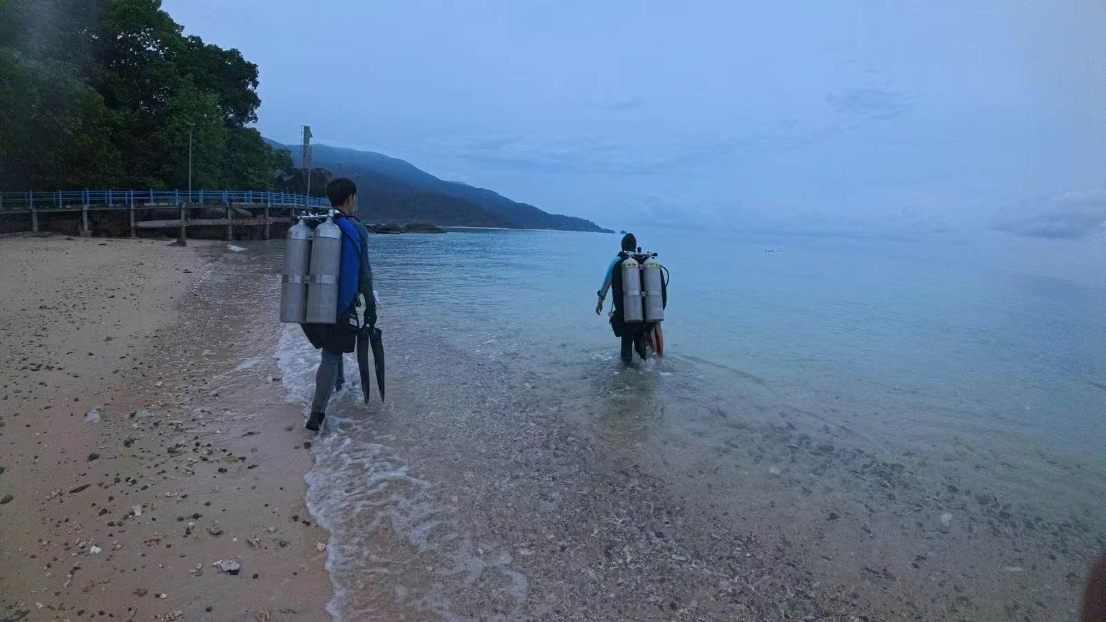
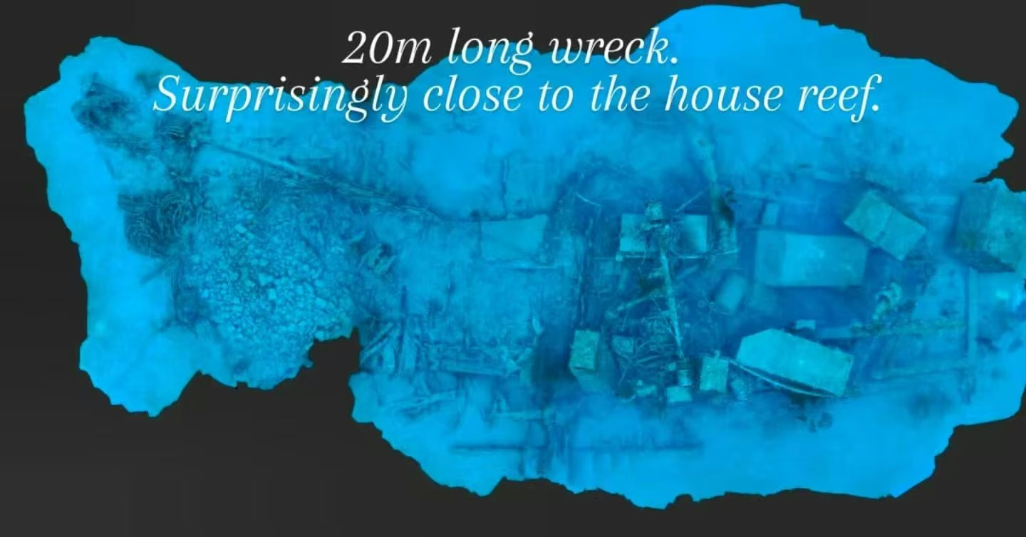
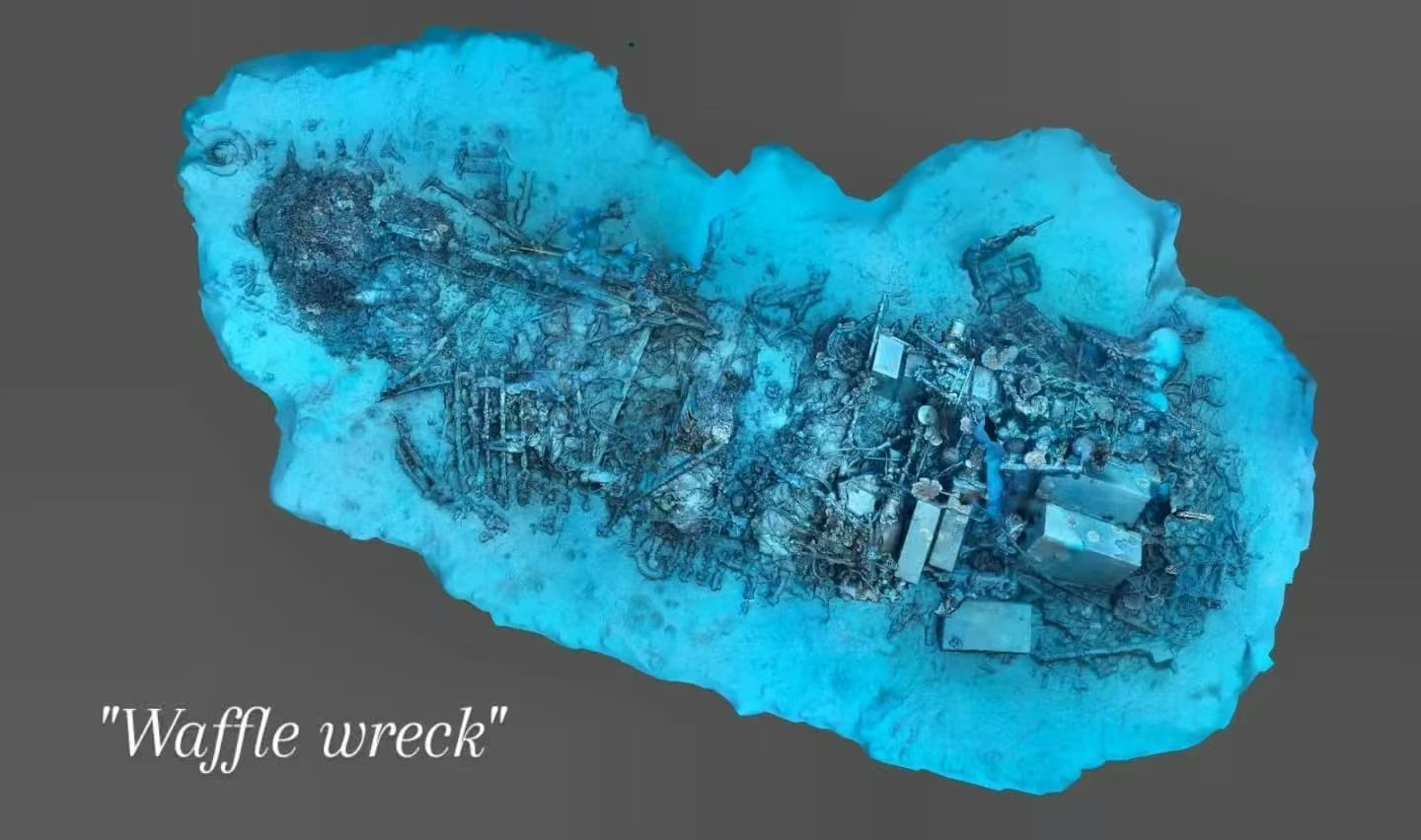
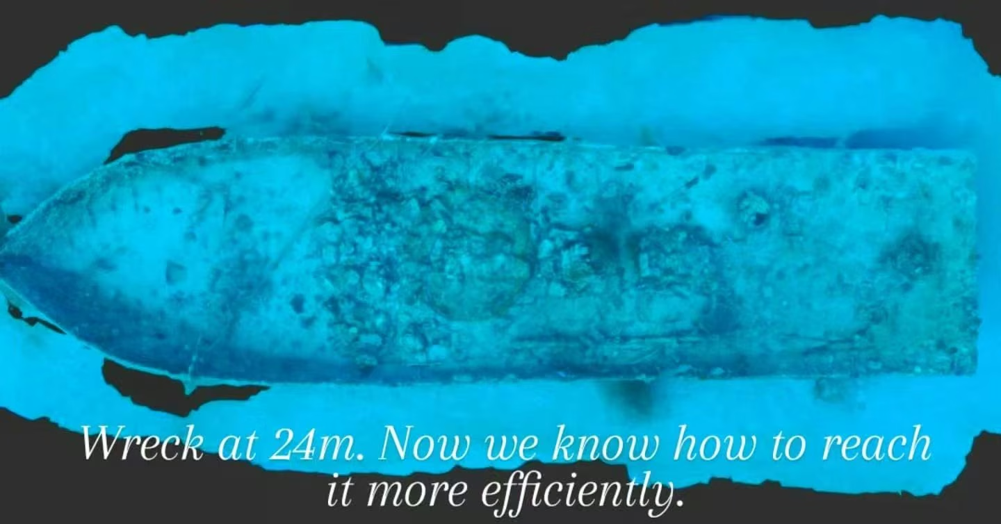
Using photogrammetry (photo sequences turned into 3D models), we've now documented four major structures down there. None of them had a proper map before; some were only rumours.
用摄影测量(把一连串照片处理成 3D 模型)的方式,我们现在已经记录了海底的四个主要结构。之前都没有正经的地图,有几个甚至只是传闻。
Explore Tyre City: Youssef has built a dedicated site documenting the tyre field, the wrecks, and the Marine Park maps - Tyre City
深入了解 Tyre City:Youssef 专门搭建了一个网站,记录轮胎区、沉船和海洋公园地图 - Tyre City
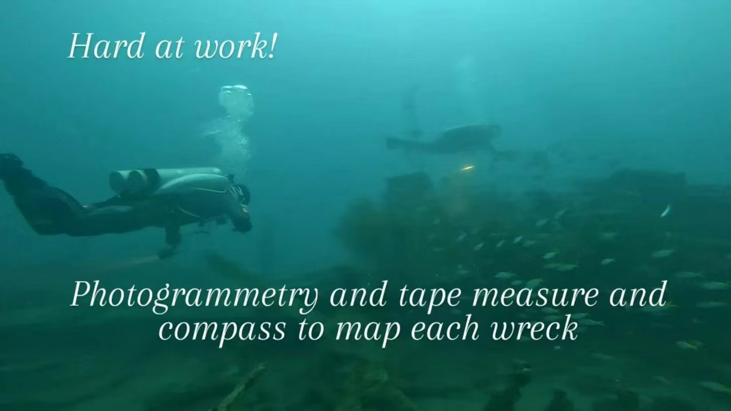
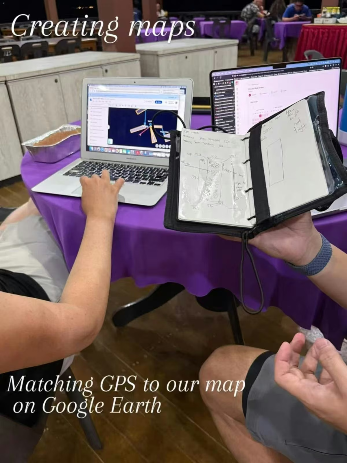
Every dive has a plan. Underwater we write distances, depths, bearings, and structure dimensions onto wetnotes with a tape measure and a compass in hand. Action cameras (GoPro, DJI, Insta360) shoot the overlapping sequences for photogrammetry. Topside, we cross-reference the notes against GPS and satellite imagery in Google Earth until the points line up into a real map.
每一潜都有计划。水下用卷尺、指南针、wetnotes 记距离、记深度、记方位、记结构尺寸。GoPro、DJI 和 Insta360 拍重叠的照片序列,给摄影测量用。回到岸上,把笔记和 GPS、Google Earth 上的卫星图一一对照,直到点位拼成一张真正能用的地图。
- Map all known and newly discovered wrecks and underwater structures across Marine Park Bay
- Create a georeferenced site map showing locations, depths, and orientation of each structure
- Use photogrammetry to generate accurate 3D models of key structures
- Document coral cover, fish population counts, and special species (eagle rays, sea turtles)
- Assess any signs of environmental degradation from the tyre structures - shifting, smothering, chemical leaching
- Research the history of the site through archival records, marine park documents, and interviews with local residents and operators
- Publish findings through the GUE Project Portal as an open, participatory survey
- 绘制海洋公园湾所有已知及新发现的沉船与水下构筑物
- 制作包含各点位置、深度与走向的地理参照地图
- 通过摄影测量法为关键构筑物生成精确的 3D 模型
- 记录珊瑚覆盖率、鱼类种群数量,以及特殊物种(鹰鲼、海龟)的出现情况
- 评估轮胎构筑物对周边环境的潜在影响,位移、掩压、化学物质渗漏
- 通过档案研究、海洋公园记录及访谈当地居民和潜水运营商,梳理该遗址的历史背景
- 通过 GUE 项目门户公开发布调查成果,欢迎社区参与贡献
Over multiple dive days, Gemma, Youssef, Jon and I have:
Gemma、Youssef、Jon 和我在多个下潜日里做了这些:
- Discovered and documented four major structures: two unnamed wrecks, the "Waffle Wreck," and the tyre field
- Completed photogrammetry models for all four structures - including the tyre field (20×25m at 25m depth) and a 20m wreck surprisingly close to the house reef
- Extended the existing wreck map to incorporate all newly discovered structures with GPS coordinates
- Practised baseline survey techniques (tape measure triangulation and compass bearings) to improve drop-point accuracy
- Initial photography and measurements of both the wreck zone and tyre zone completed
- Substantial data collected and currently under analysis
- 发现并记录四处主要构筑物:两艘未命名沉船、"华夫饼"沉船,以及轮胎区
- 完成全部四处构筑物的摄影测量建模,包括轮胎区(水深 25 米、面积约 20×25 米)及一艘意外靠近房屋礁的 20 米沉船
- 在已有沉船地图基础上,将所有新发现构筑物附带 GPS 坐标纳入地图
- 练习基础测绘技术,卷尺三角定位与指南针方位测量,提升下潜落点精度
- 完成对沉船区和轮胎区的初步摄影记录与测量
- 带回大量数据,目前正在整理分析中
Next up: turning the photogrammetry models and field data into a publishable site map. Something future divers can actually use. We're also starting on the history side: which government body sank the tyres, when, and what (if anything) is on the record about the wrecks.
Further out, we want to see if we can design real exploration activities here. Less passive sightseeing dive, more chance for visiting divers to contribute observations into the survey.
接下来要做的:把摄影测量模型和田野数据整理成一份可以公开的点位地图。让以后来潜的人真正能用上。同时开始查历史:是哪个政府部门当年沉的轮胎,什么时候沉的,那些沉船有没有留下任何记录。
再远一点,我们想看看能不能在这里设计真正的探索活动。不只是"来看一个点",而是让来潜的人也能把自己的观察加到调查里。
One thing I like about this project: the bar to join isn't as high as it looks. Most of the work has been done with a tape measure, wetnotes, a compass, a GoPro, a DJI, and an Insta360. Twin cylinders help in the deeper tyre zone at 25m, but a lot of the bay, including coral gardens at 6m, is well within recreational range. If marine survey and exploration interests you, come dive with us.
这个项目我最喜欢的一点:门槛其实没那么高。大部分工作就是靠卷尺、wetnotes、指南针、GoPro、DJI、Insta360 一点点做出来的。25 米的轮胎区有双瓶会更舒服,但这片海湾很多地方都浅,珊瑚礁就在 6 米左右,休闲潜水员完全可以来。对海洋调查和探索有兴趣,欢迎一起下潜。
gemma@gue.com
Moby Tek Dive Centre, Tioman Island, Malaysia Moby Tek 潜水中心,刁曼岛,马来西亚
Youssef Diouri - photogrammetry & expedition documentation · Dive With Youri摄影测量与探险记录 · Dive With Youri